The eight "Route Signs" in Tibet (II)
Route Sign 5: The over-head cables have been withdrawn
In the past years, over-head cables were the only “big bridge” helping people living in the remote high mountainous areas leave from the big mountains. “Trappy narrow passes and over-head-cable foot-logs” is real description about the difficulty in traveling faced by the local people.
In 2009, Tibet invested 220 mln yuan commencing the “Change Over-head Cables into Bridges” Project, transforming 84 over-head cables in the four areas (cities) of Qamdo, Nyingchi, Shigatse and Nagqu into bridges. After 4 years of construction, the project was completed in 2013. Nowadays, over-head cables in Tibet have become history, 40,000 farmers and pastoralists have embarked on the “golden bridges” that bring the way to shaking off poverty and allow them to become better off.
Route Sign 6: The Lhasa – Shigatse Railway has been completed
As an expanding route of the Qinghai-Tibetan Railway, the Lhasa – Shigatse railway that is 251-kilometter long was officially opened to traffic on the 15th of August 2014. The Lhasa-Shigatse Railway being in use has marked the connection between the resident places of Dalai Lama and Panchen Lama by the modern railway for the first time, totally ending the historical period when the southeastern part of Tibet purely depended on road traffic. During the last one year since the railway has been opened to traffic, it has realized the passage of over 600,000 passengers.
According the state plan, the Lhasa – Shigatse Railway will reach the Qinghai-Tibet Railway to the North and to the South will meet with the railways that connect Shigatse with Nyalam, Shigatse with Gyirong as well as Shigatse with the Yadong Border Checkpoint, basing upon which, the international railway passage going to Nepal and India will be constructed soon.
Route Sign 7: Public Road mileage surpasses 70,000 kilometers
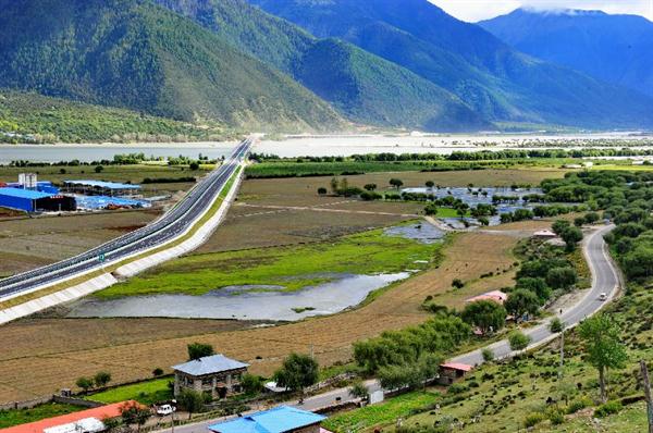
In 1965, the total nationwide mileage was just barely over 14,000 kilometers. After 50 years of construction, nowadays this number has reached 75,000 kilometers, gradually forming a public road transportation network that is centered at Lhasa and framed by the “three vertical passages, two horizontal passages and six other passages”. Connecting different cities and areas, counties and townships, this transportation network reaches Sichuan, Yunnan to the east, meets Xinjiang to the west and successively connects with Qinghai to the north as well as India and Nepal to the south.
Following the increasing expanse of public roads, those narrow earth footpaths have been replaced with asphalt public roads. Along the public roads, farmers and pastoralists are running home-stay businesses, moving on their way to a better-off life one after another.
Route Sign 8: Civilian motor vehicles have surpassed the number of 300,000
More than 60 years ago, Tibet did not have a single so-called modernized public road, the car that the 14th Dalai Lama used was dismounted and carried from India to Lhasa by horses and then put back together there. There was only this car in the whole of Tibet and it also could only be used on the about 2-kilometer public dirt road between the Norbulingka and the Potala Palace.
Following economic and social development, Tibetan people’s consuming capacity has increased. Nowadays, in Tibet, a region with the population of only about 3 million people, the motor vehicle retention has climbed to the number of 300,000; and motor vehicle retention per capita has surpassed the nationwide average standard. The number of motor vehicles in Lhasa City has reached 150,000, 80% of which are private cars; at average, 1 in every 6 people have a car.
In spite of the rapid development, due to the natural and historical restrictions, Tibet remains the “short slab” in the nationwide transportation system. For this, the Ministry of Transportation has issued Some Ideas Regarding Carrying Forward the Scientific Development of Tibetan Transportation, in order to expedite completion of the Tibetan transportation system. It is planned that, by 2020, the total public road mileage lengths will surpass 110,000 kilometers, the total public road mileage lengths in the rural areas will surpass 70,000 kilometers, the total high-grade main highway mileage length will surpass 1,200 kilometers, forming “3-hour synthesized transportation circle” that is centered at Lhasa and covers 6 areas (cities). At the appointed time, “the Heavenly Tibet” will no longer be too far.
Your Comment
Name E-mailRelated News
-
;
-
-

-
Lhasa: the 2016 spring festival transportation kicked off
On January 24th, 2016 the national Spring Festival transportation kicked off.
-
-
-
-
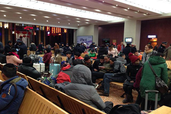
1st Day for Spring Festival transportation on Qinghai-Tibet Railwa
On Jan. 24, the Lhasa railway station square is full of passengers; the ticket office hall is filled with crowds queuing in line waiting to collect their tickets.
-
-
-
-
Introduction to transportation in Tibet
Tibet is constantly improving its large traffic pattern which has already become a comprehensive transportation system.
-
-
-
-
Development of transportation in Tibet over past 5 decades
Photo taken on Aug. 29, 2014 shows the Lhasa-Gonggar Airport highway, southwest China's Tibet Autonomous Region.
-
Based in Lhasa, Tibet Vista is a Tibet travel agency that specialized in Tibet permit, and Tibet tours for both private and group travelers at a local price!
•4 Days Lhasa City Group Tour from USD 460 •8 Days Everest Base Camp Group Tour from USD 850 •15 Days Mt.Kailash Group Tour from USD 1780 •2016 Tibet Train Tours from Beijing, Shanghai, Chengdu, Xining,etc


